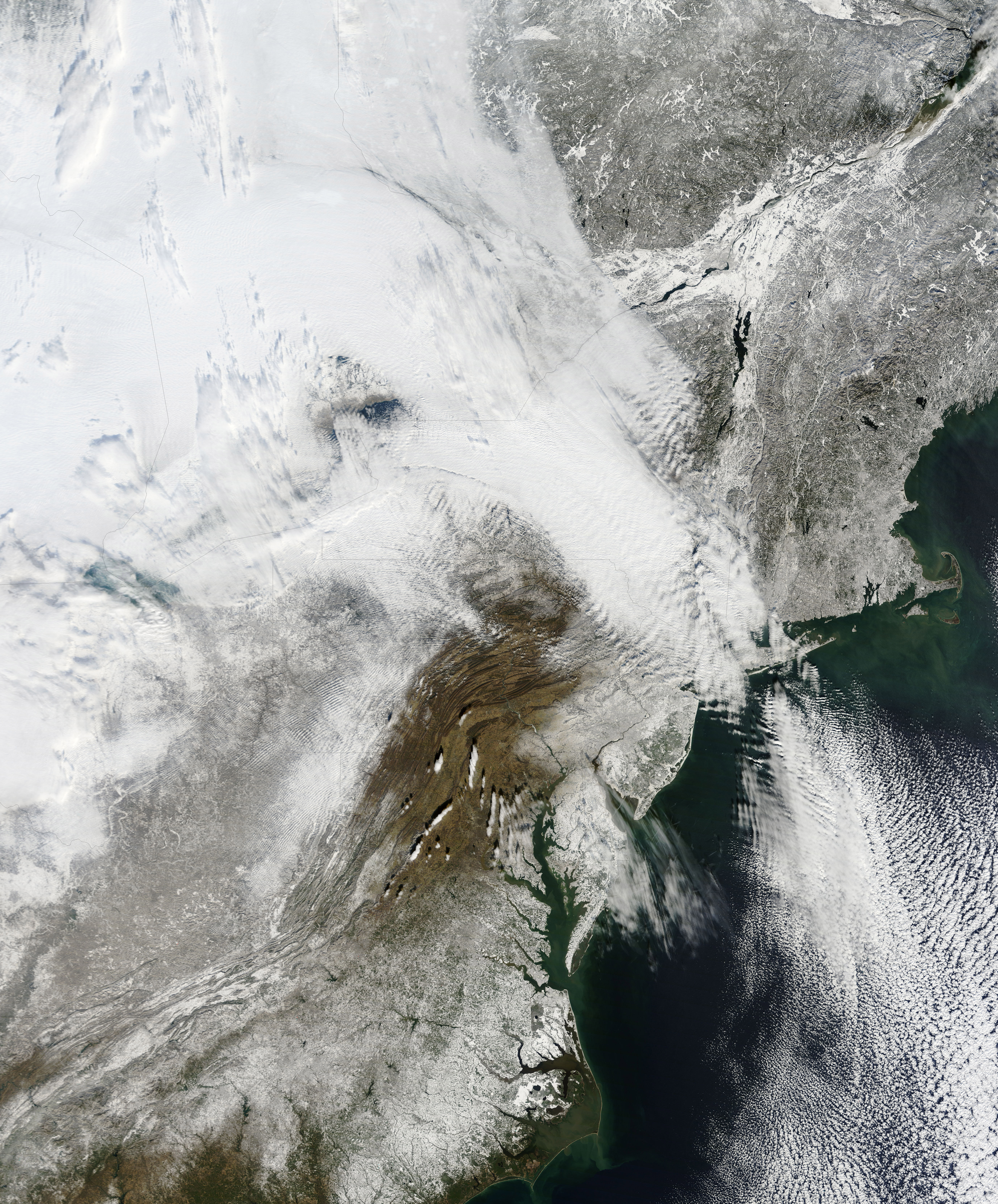
NASA has released a new high resolution satellite image of the North Eastern region of the United States covered in over 80cm of snow.
NASA has already released satellite imagery of the continent blanketed in snow. You can see the accumulation of snow in this time lapse video.
New York can be found above the darker grey area at the centre of the image.
The Moderate Resolution Imaging Spectroradiometer (MODIS) on NASAs Terra satellite captured this natural-color image of the northeastern United States and part of Canada on December 28, 2010. Snow and clouds blend rather seamlessly, but can be distinguished by their different textures. The wide swath of uniform white that extends from Michigan and Ontario toward the southeast is a cloudbank. Under clear skies, snow cover from the storm creates a mottled appearance across New England and southeastern Canada. Farther south, the snow appears to have missed much of central Pennsylvania.
NASA
The image was recorded on December 28th by NASA’s MODIS satellite.
DARPA's O-Circuit program looks to build a new class of biologically inspired computer equipped with…
As AI races into classrooms worldwide, Google is finding that the toughest lessons on how…
The push to eat bugs is not an organic movement coming from the people, but…
As Africa’s digital economy accelerates, a new partnership between the Africa Digital Assets Summit 2026…
The State of Generative AI in the Enterprise report from Menlo Ventures found that companies…
Living therapies, made of engineered immune cells – and capable of hunting down cancer, reversing…
View Comments